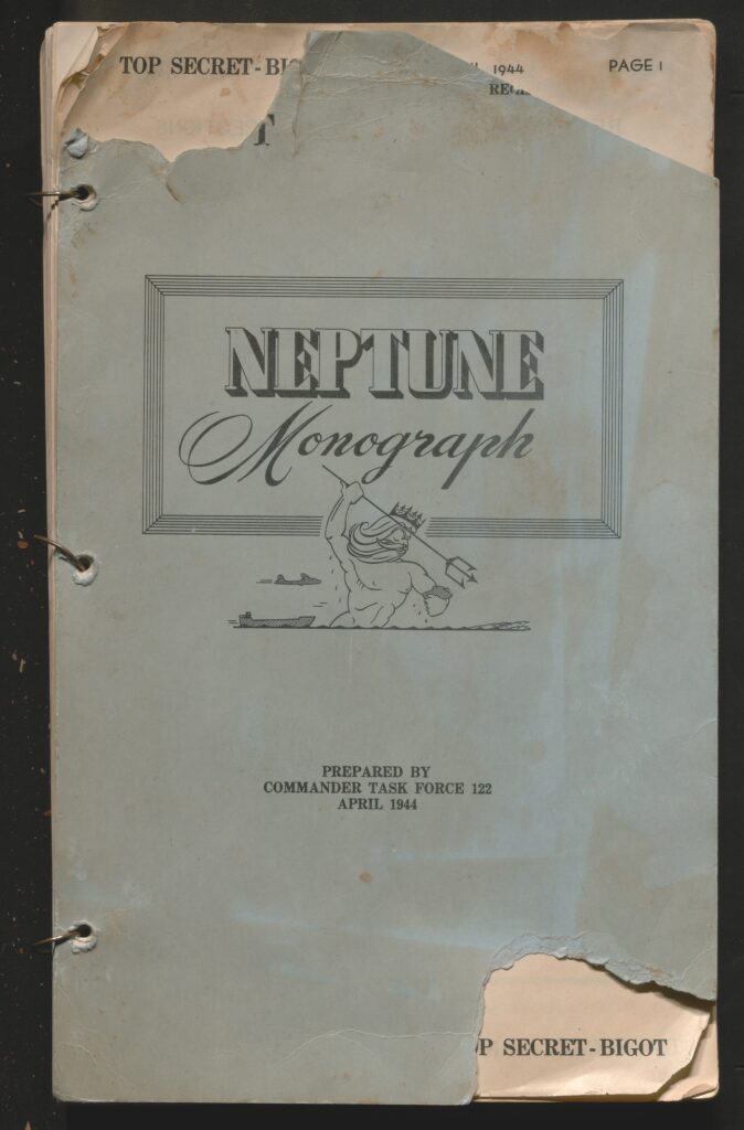
Operation Neptune represents the Naval Landing aspect of the Normandy Landings of June 6th, 1944, also known as D-Day. The landings of Operation Neptune would go on to be the largest amphibious landing in human history and the beginning of the liberation of Occupied France by the allied forces. This specific document covers the Western Task Force landing plans comprised primarily of US forces under the First Army.
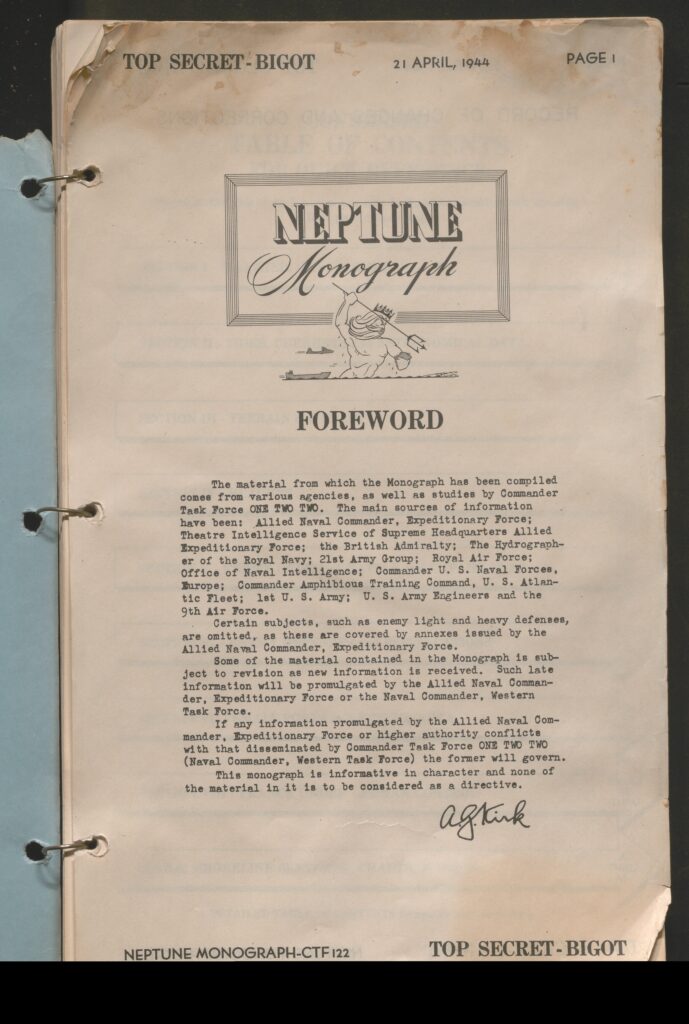
This Operation Neptune Monograph, designated Top-Secret BIGOT, holds the highest level of classification for top-secret documents in World War 2.
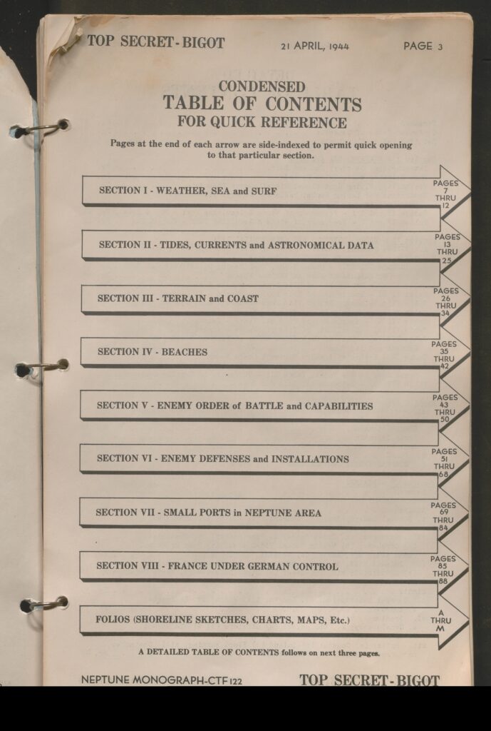
The monograph contains the following sections and breakdowns for the Western Task Force/; US First Army landing beaches Ohama and Utah
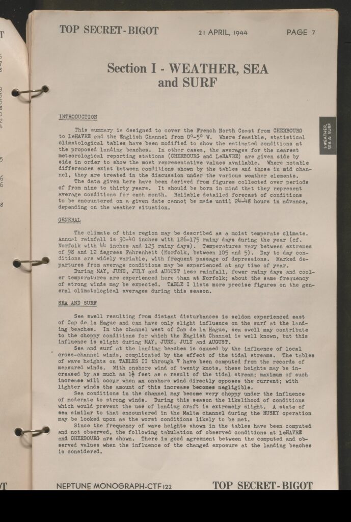
- Section 1: Weather, Sea and Surf
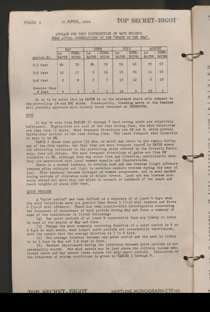
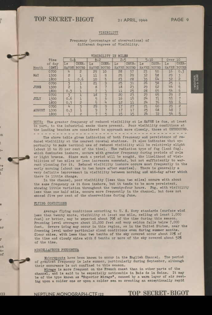
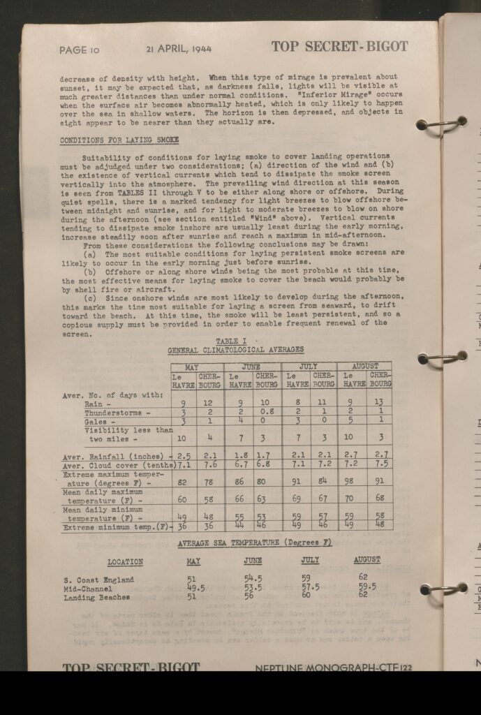
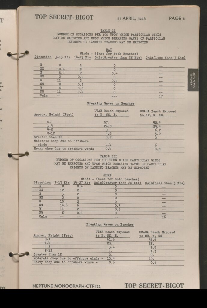
- Covers the landing zones between Cherbourg and LeHavre including climatological information, estimated weather conditions, and weather elements
- This also explores the required conditions to lay smoke
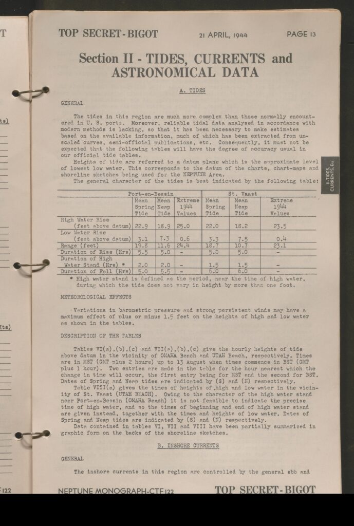
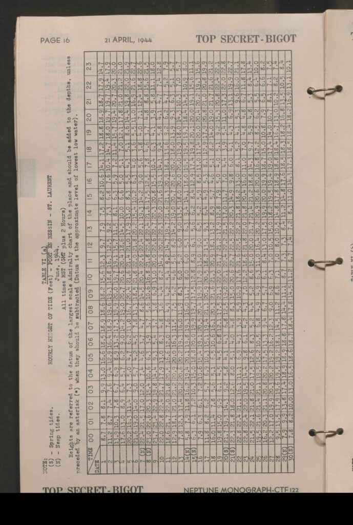
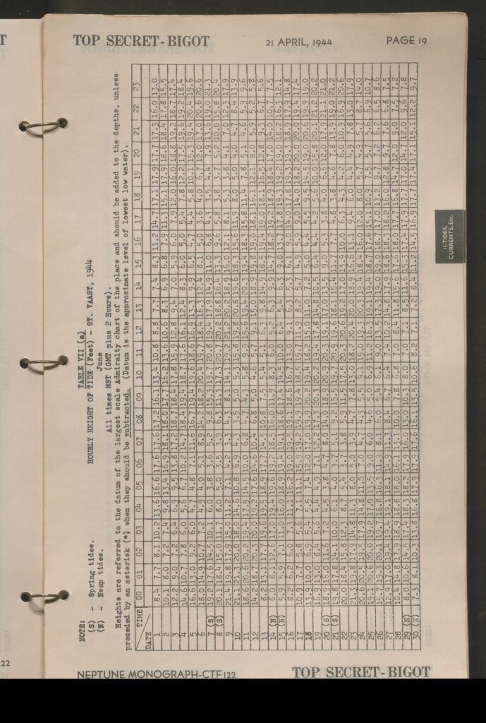
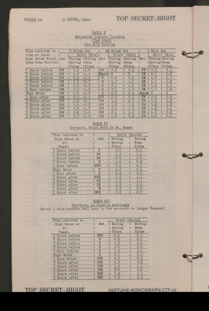
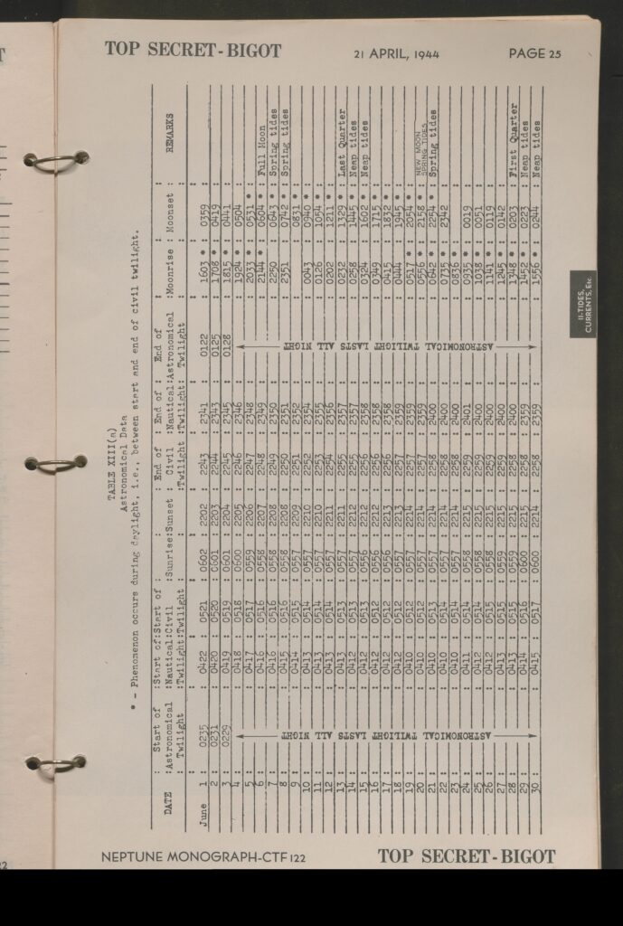
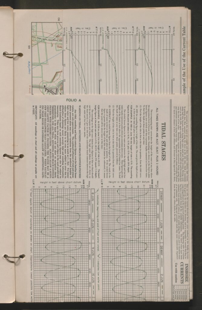
- Section 2: Tides, Currents and Astronomical Data
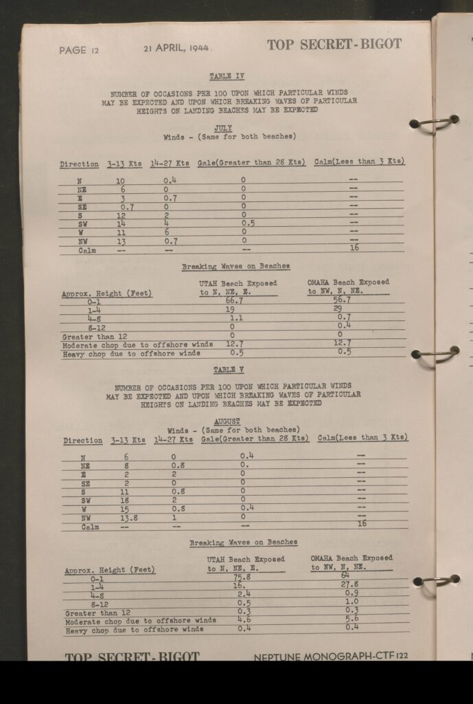
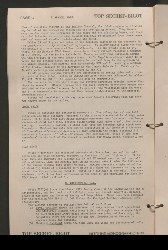
- Detailed exploration of the tide conditions of the region and provides the tide tables for the proposed landing zones
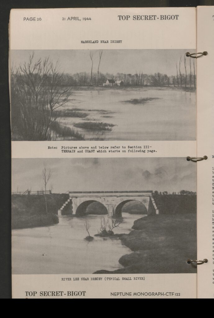
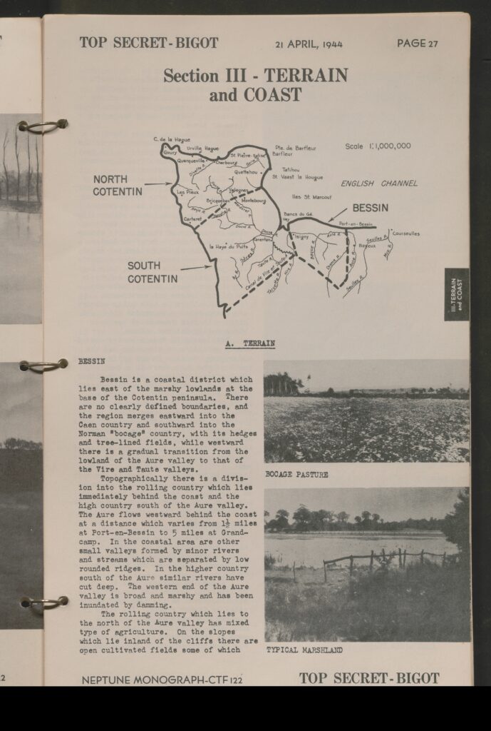
- Documentation on the marshlands in the regions near Isigny and rivers near Brecey,
- Section 3: Terrain and Coast
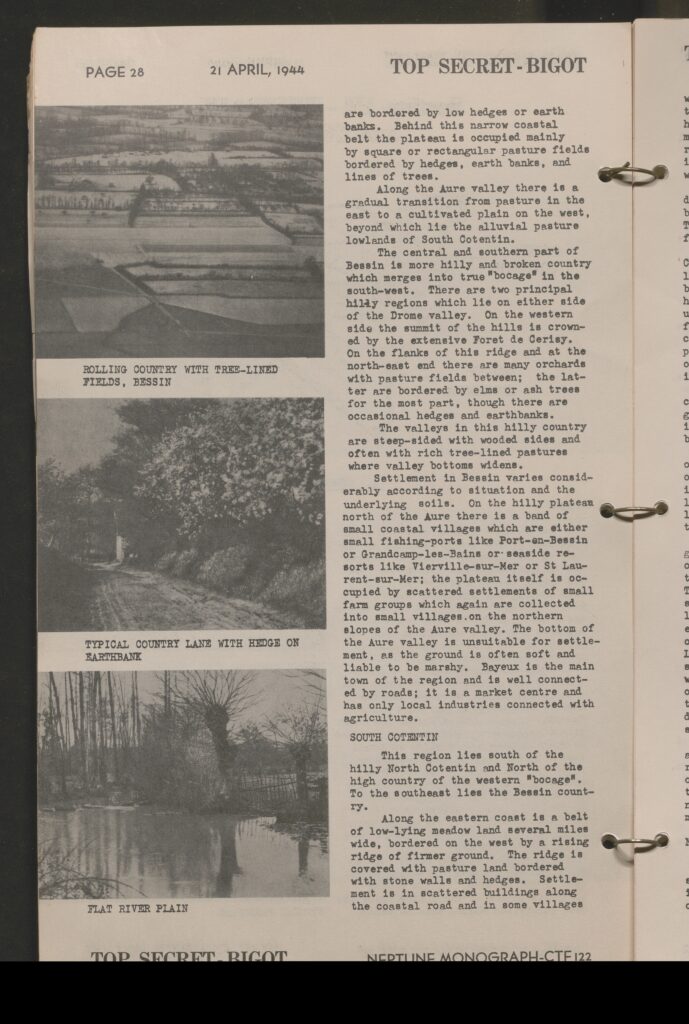
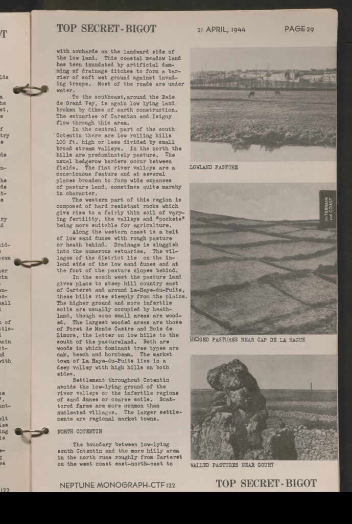
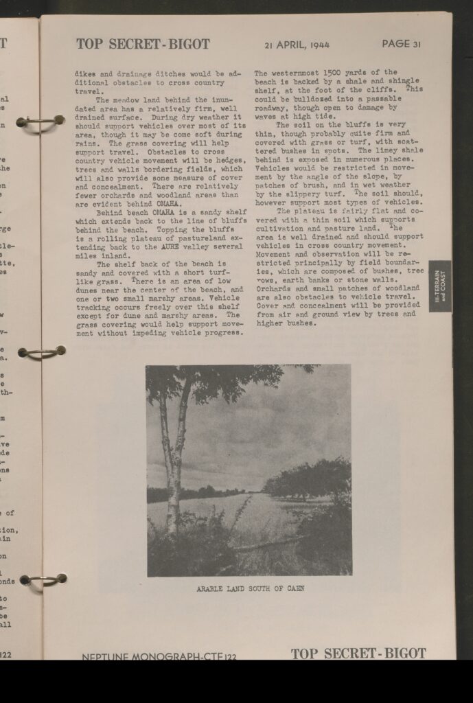
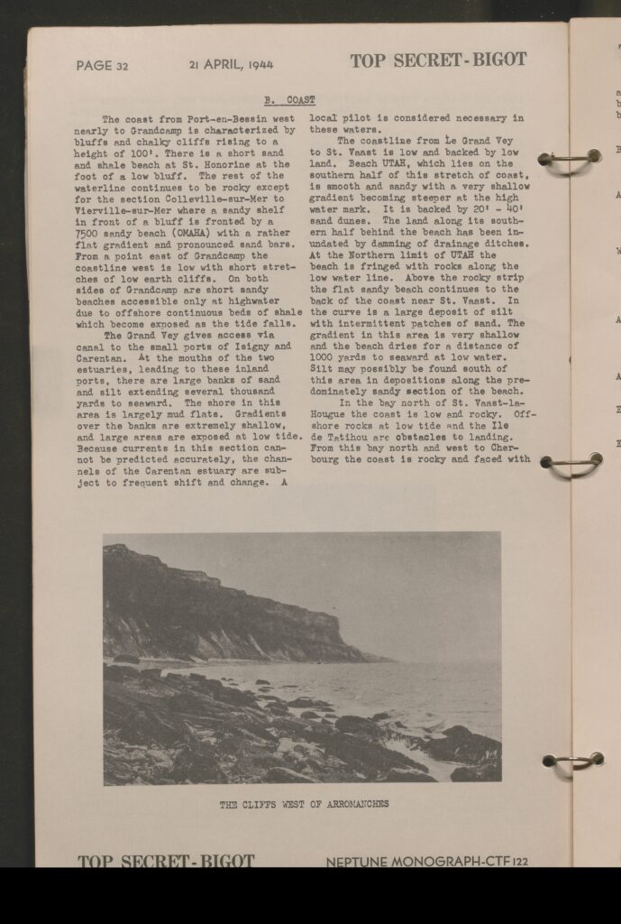
- Covers the coastal region, standard terrains in said region (including pastures, arable farmlands, typical marshland, hedgerows, river plains) by village and city. Some of these explore the specific makeups of the ground in the area to establish the feasibility of moving heavy vehicles and tracked vehicles in the region or to support airborne operations.
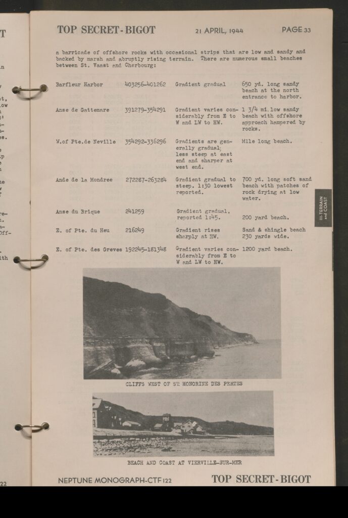
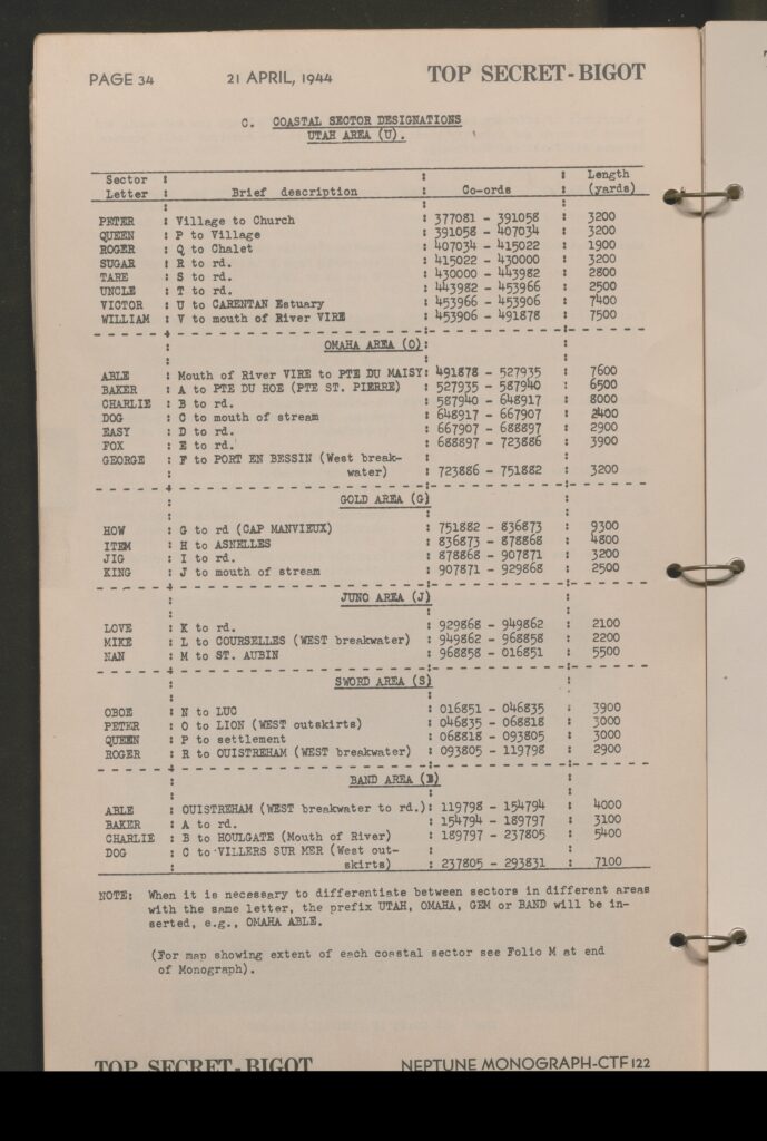
- Coastal regions are evaluated in detail as well to establish potential landing beaches, the conditions and makeup of said beachheads, size and depth of the beaches and a table is provided with coordinates and lengths designating the individual beachhead sector designations as well.
- Section 4: Beaches
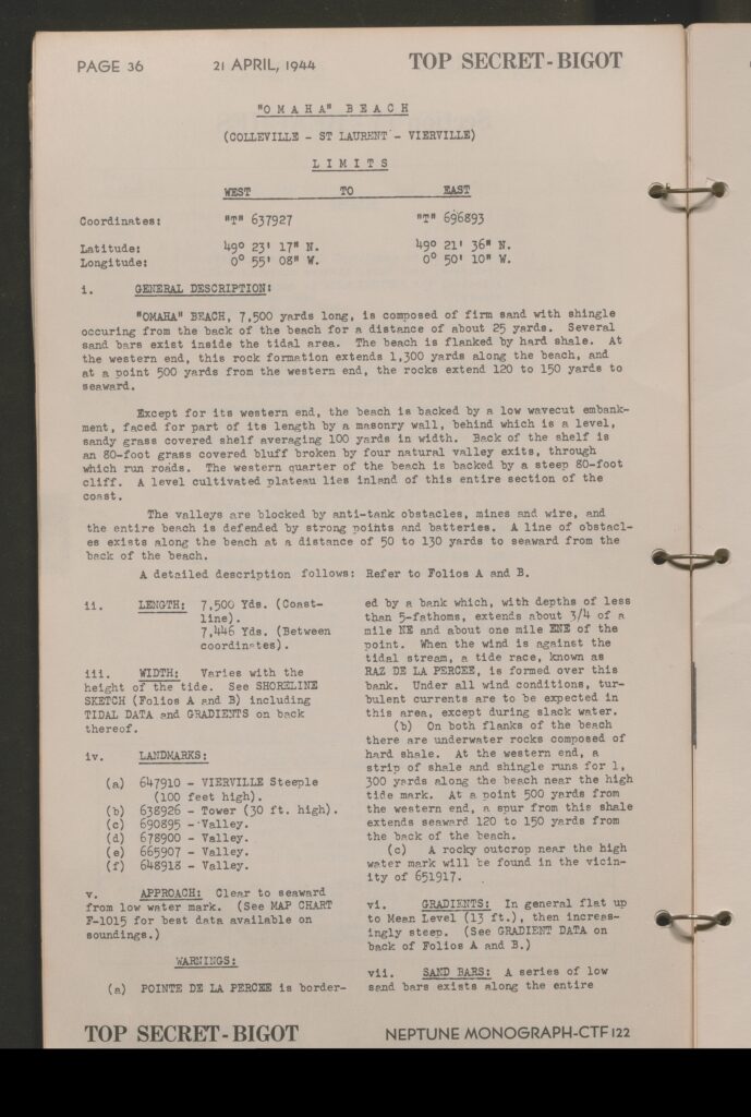
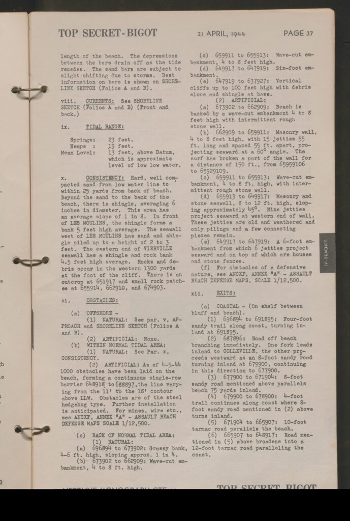
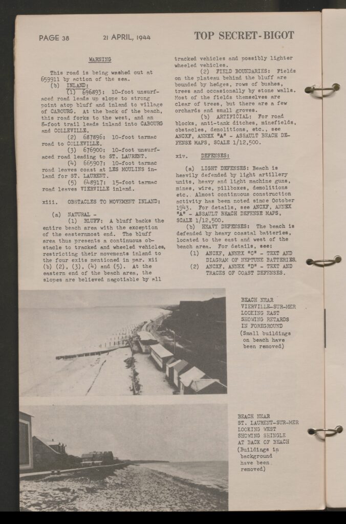
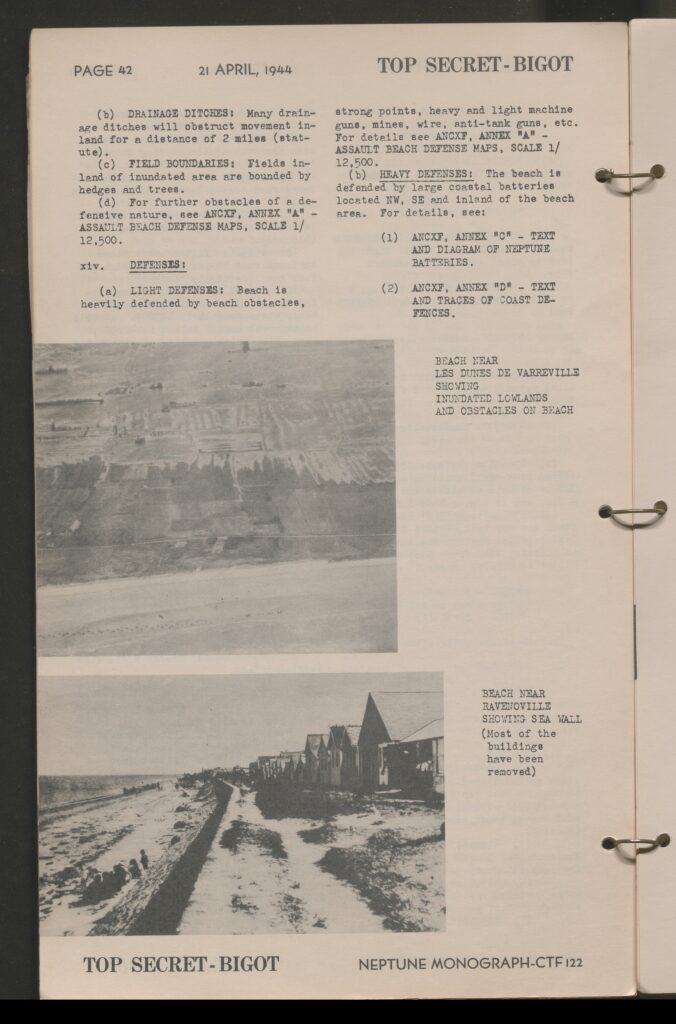
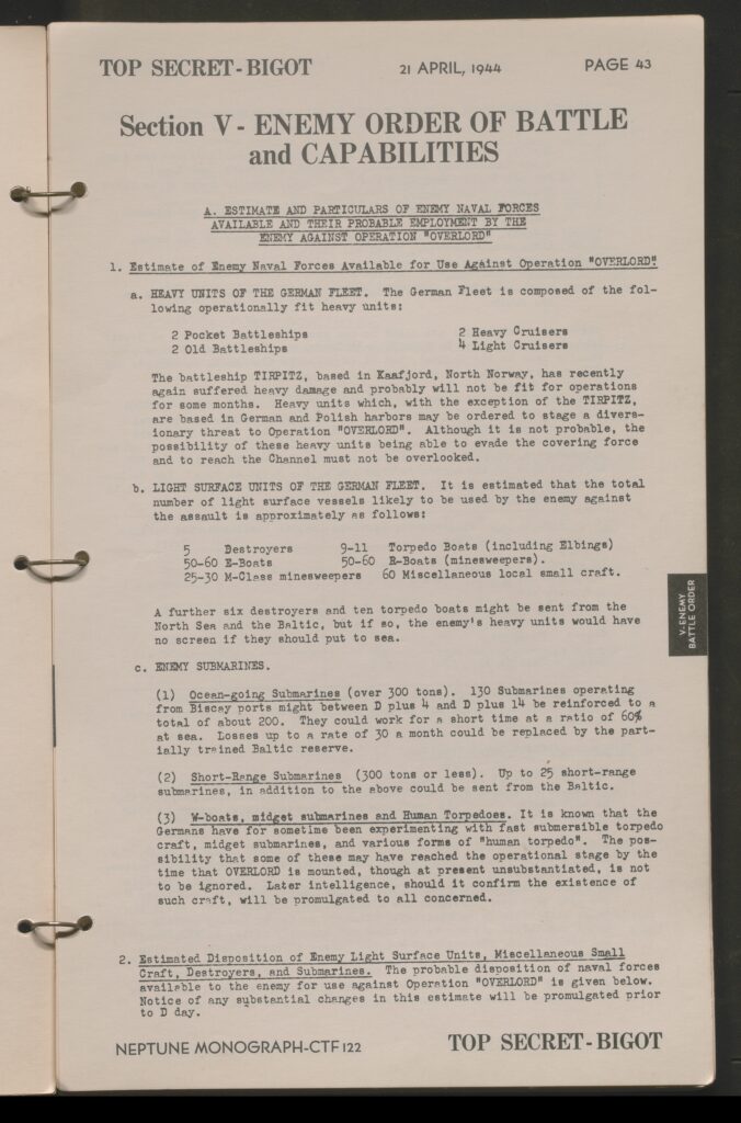
- General Descriptions of beacheads, lengths, width, landmarks, approaches for landing, gradients, exit routes, and known obstacles for Utah and Ohama Beachheads.
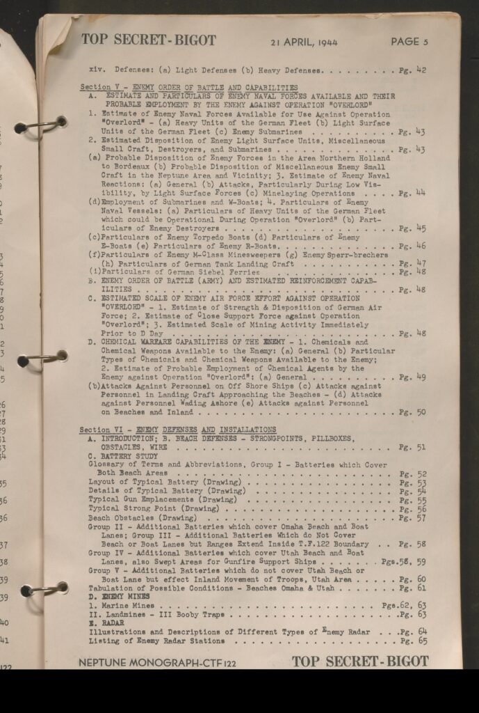
- Section 5: Enemy Order of Battle and Capabilities
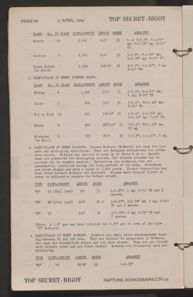
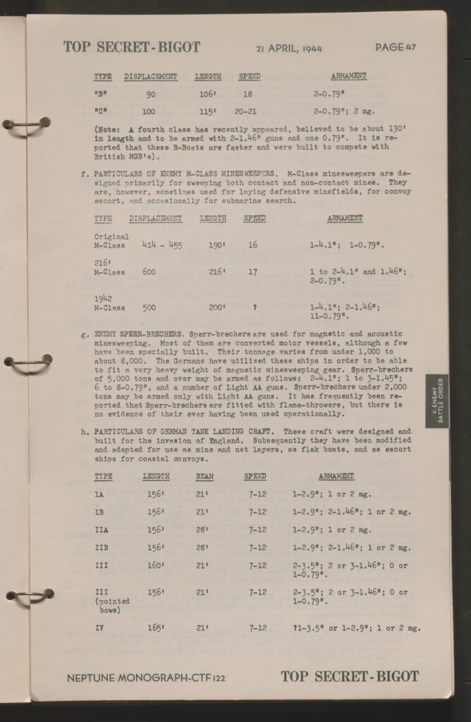
- Breakdown of available Axis Naval forces expected to respond to the landings as well as the conditions of the Battleship Tirpitz in Norway, estimated known submarine fleet in the region, list of known surface vessels and small craft as well as their anticipated response to the landing.
- This includes a breakdown of the speeds and displacement of these vessels
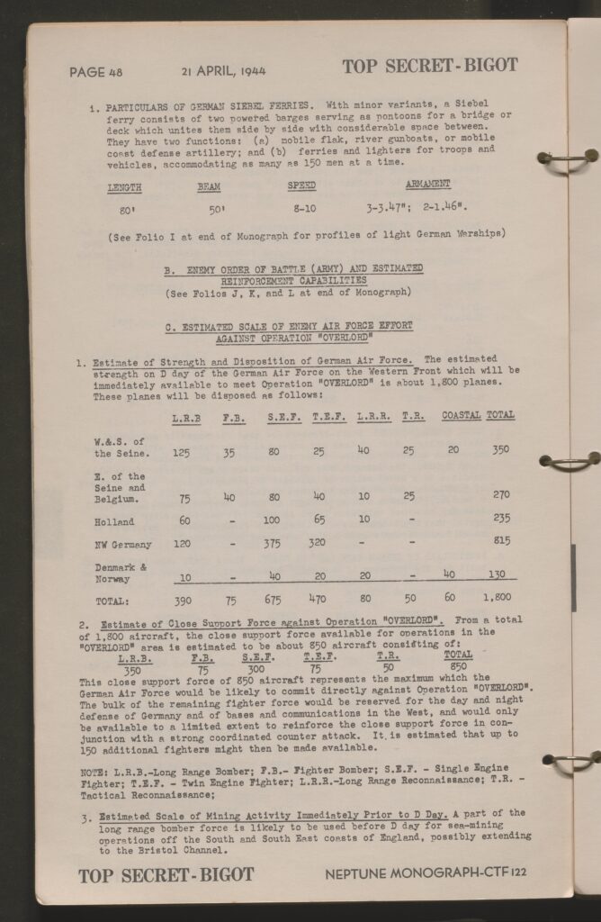
- Breakdown of known Luftwaffe assets on the German Western Front (Europe)
- Estimate of aircraft available stating a believed 1,800 aircraft remained in use on the Western Front with 850 available to potentially respond to Operation Neptune.
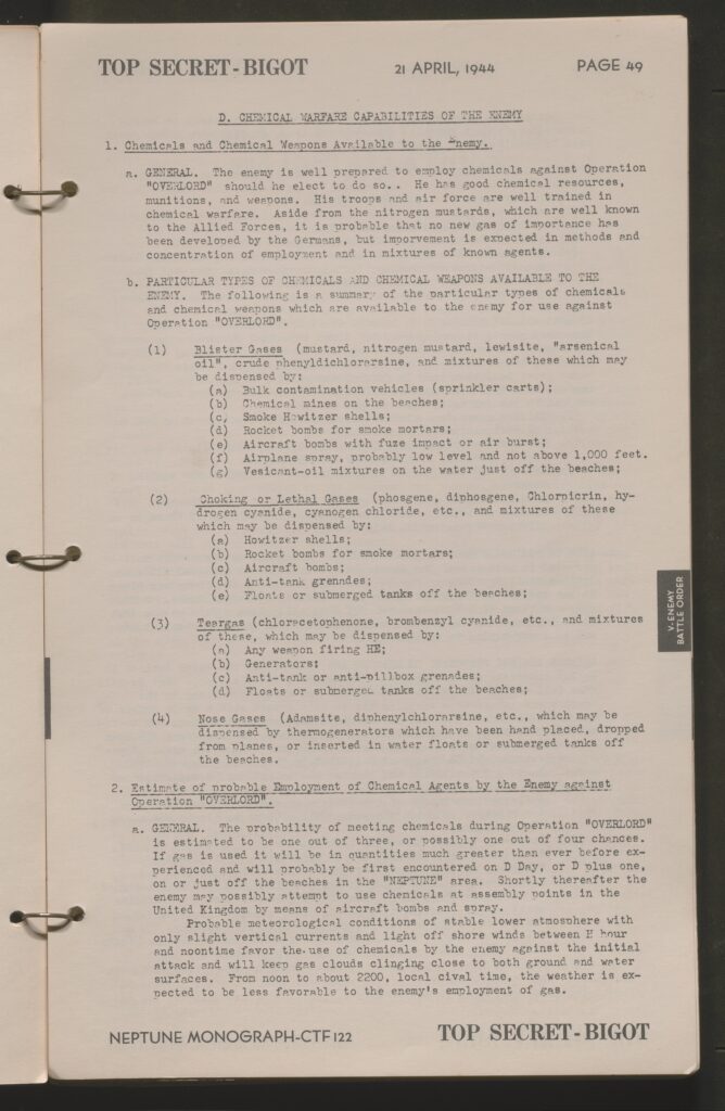
- Breakdown of Chemical Weapons available to the German forces in Europe
- Breakdown of available Axis Naval forces expected to respond to the landings as well as the conditions of the Battleship Tirpitz in Norway, estimated known submarine fleet in the region, list of known surface vessels and small craft as well as their anticipated response to the landing.
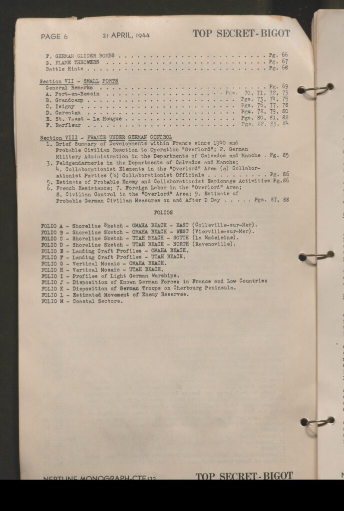
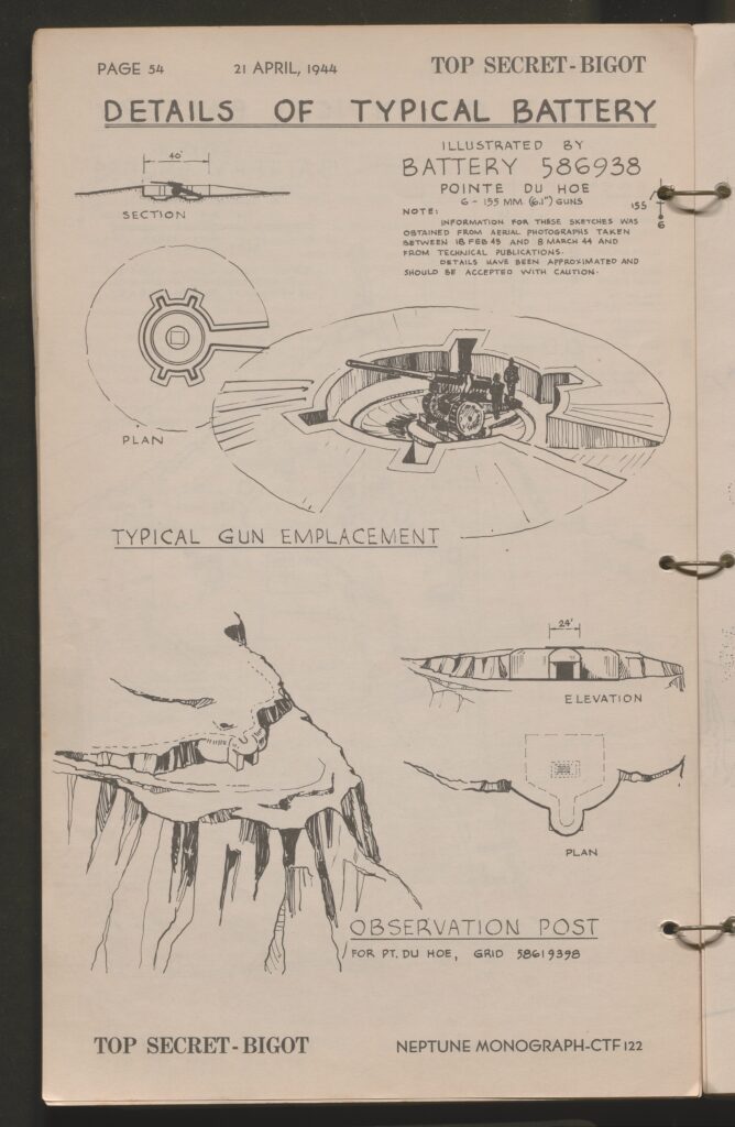
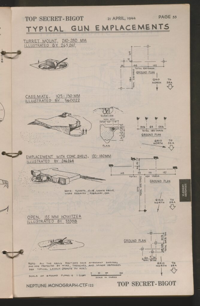
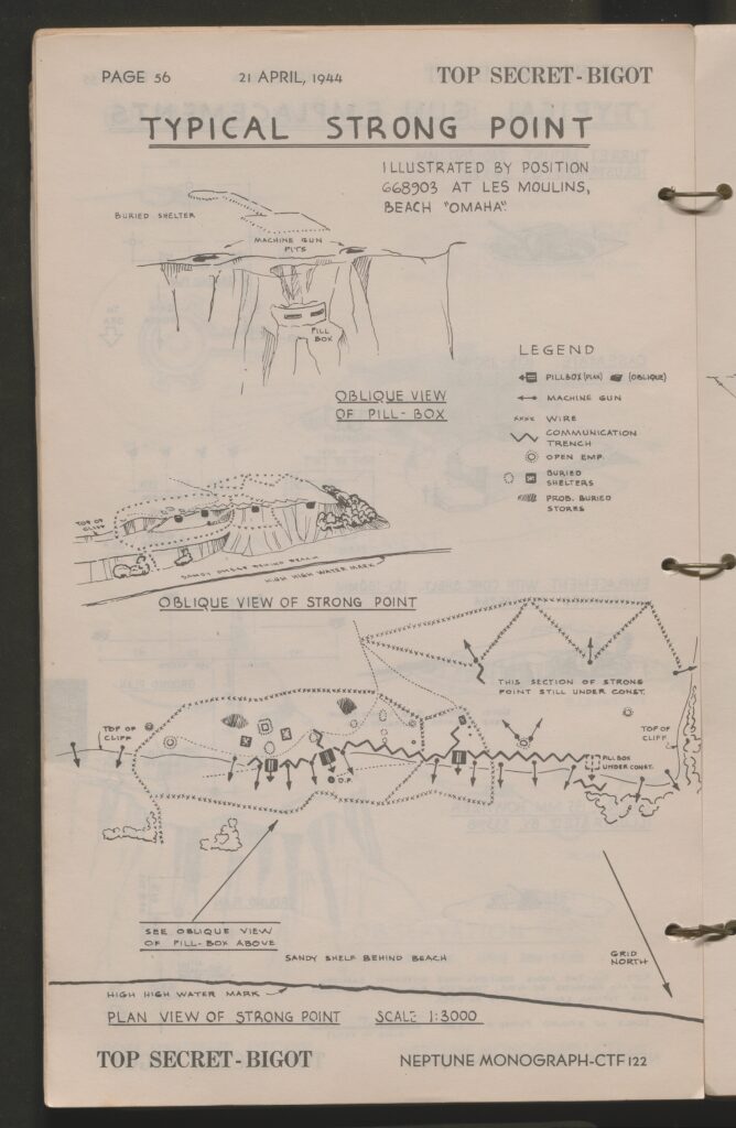
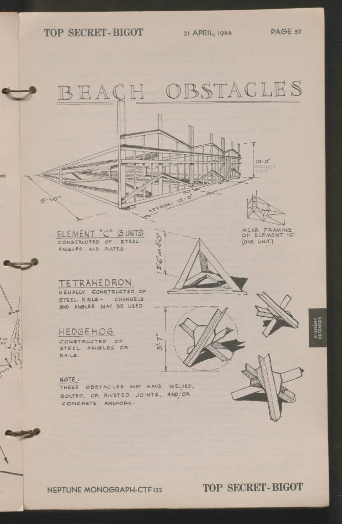
- Section 6: Enemy Defenses and Installations
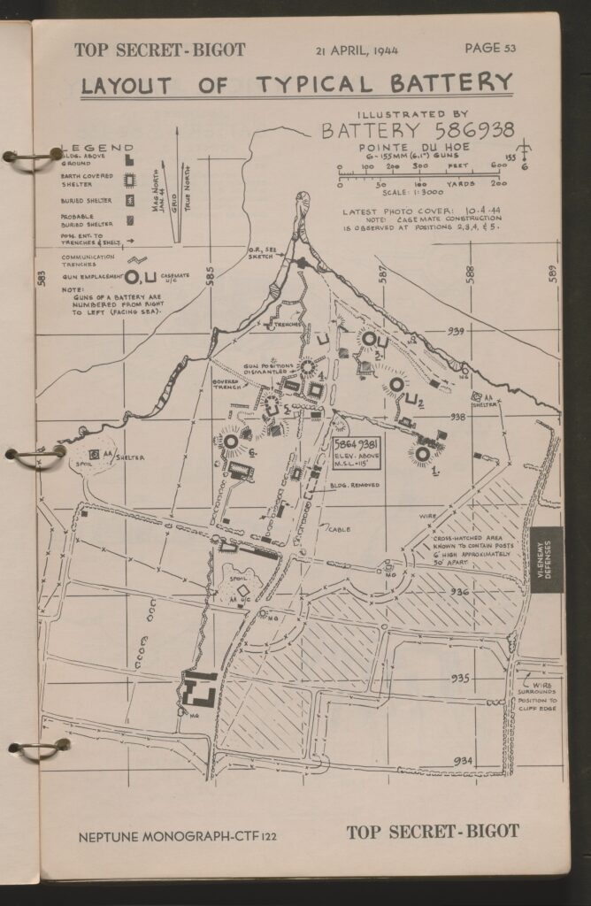
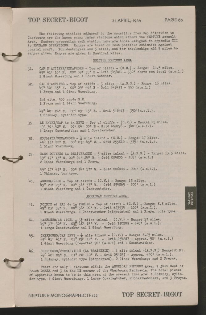
- Evaluation of German defenses, tank obstacles, gun emplacements, trench lines, battery locations, casemates, and battery layouts (including a map of Battery 586938 listed as Pointe Du Hoe (Pointe Du Hoc).
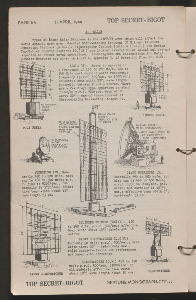
- Illustrations of said defensive emplacements, strongpoints and beach obstaclesIllustrations and evaluations of German Radar systems and structures
- Detailed evaluation of German glider bombs (Henschel 293), Radio corrected (guided) bombs (Type F.X.) and flamethrowers.
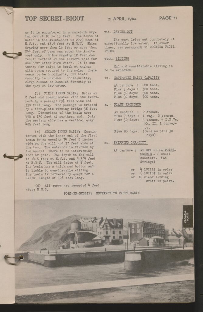
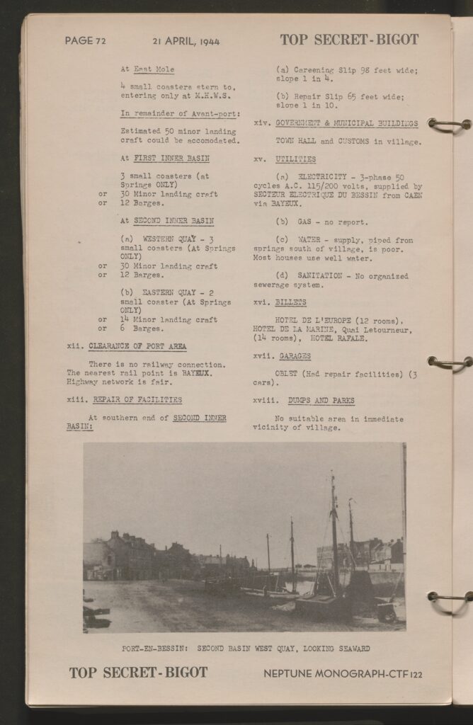
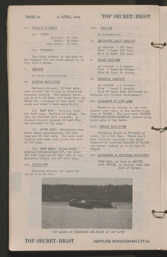
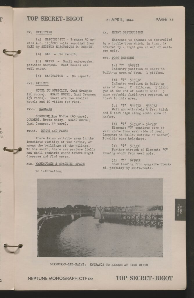
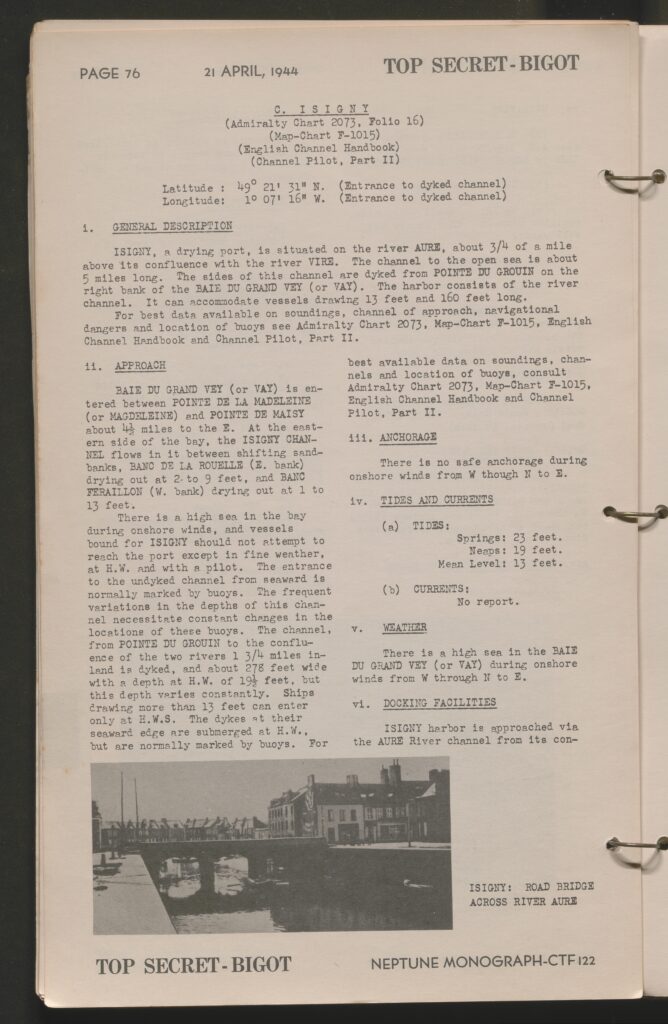
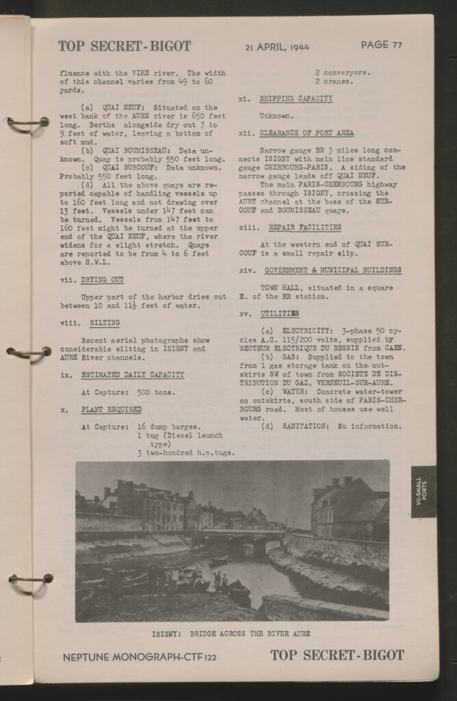
- Section 7: Small Ports in Neptune Area
- Evaluation of the condition, size, capabilities, estimated daily tonnage, channel width, channel soil, and tides/currents of Small Ports in the region of Normandy
- Photos and estimated number of landing crafts and barges that could be used in these ports are included
- List of known defenses in said ports are also included
- Photos and estimated number of landing crafts and barges that could be used in these ports are included
- Evaluation of the condition, size, capabilities, estimated daily tonnage, channel width, channel soil, and tides/currents of Small Ports in the region of Normandy
- Section 8: France Under German Control
- This section evaluates military and civil developments in France since 1940 as well as the anticipated probable civilian response to the landings.
- This includes the location of all known civil and military liaison offices in France
- This section evaluates military and civil developments in France since 1940 as well as the anticipated probable civilian response to the landings.
- Folios: Shoreline Sketches, Charts, Maps, Etc.
- The Folios include
- Fold out maps showing road, building, defense, and terrain locations as well as tidal stage evaluations of Omaha Beach East (Colleville-sur-Mer), Omaha Beach-West (Vierville-sur-Mer), Utah Beach-South (La Madeleine), Utah Beach-North (Ravenoville).Aerial Reconnaissance photos of Omaha and Utah Beaches with marked road exits and widthProfiles of German Light Warships known to be in the region
- Landing Craft Profiles in relation to the known beach gradient of Utah Beach-North and Utah Beach-South (it is unknown to us at this time if a separate Landing Craft Profile was ever present for Ohama Beach)Known disposition and locations of German Forces in France and the Low Countries
- Known disposition and location of German troops in the Cherbourg Peninsula as of April 1944. Estimated movements of German forces in response to a landing in the region of Normandy
- The Folios include
This item has been fully digitized by Archival Arms and is a direct example of the specific monograph we have previously sold.
Complete scan of the document

0 Comments